
Survey
After map study, engineering or field survey are carried out to finalize the highway alignment. The object of these surveys is to locate the alignment of a road which provides maximum transportation facilities with the minimum cost of construction and maintenance.
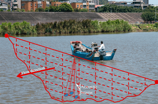
Bathymetric Survey
Bathymetric survey, sometimes referred to as a fathometric survey, is a type ofhydrographic (water-based) survey that maps the depths and shapes of underwaterterrain to illustrate the land that lies below.
Bathymetric surveyors work to obtain an exact representative image of the seabedand identify specific elevations, anomalies, and the presence of any scour aroundsubmerged structures.
They also analyze and define the surrounding shorelines, tides, currents, and wavesto create a better model of the area features overall.